Day 62

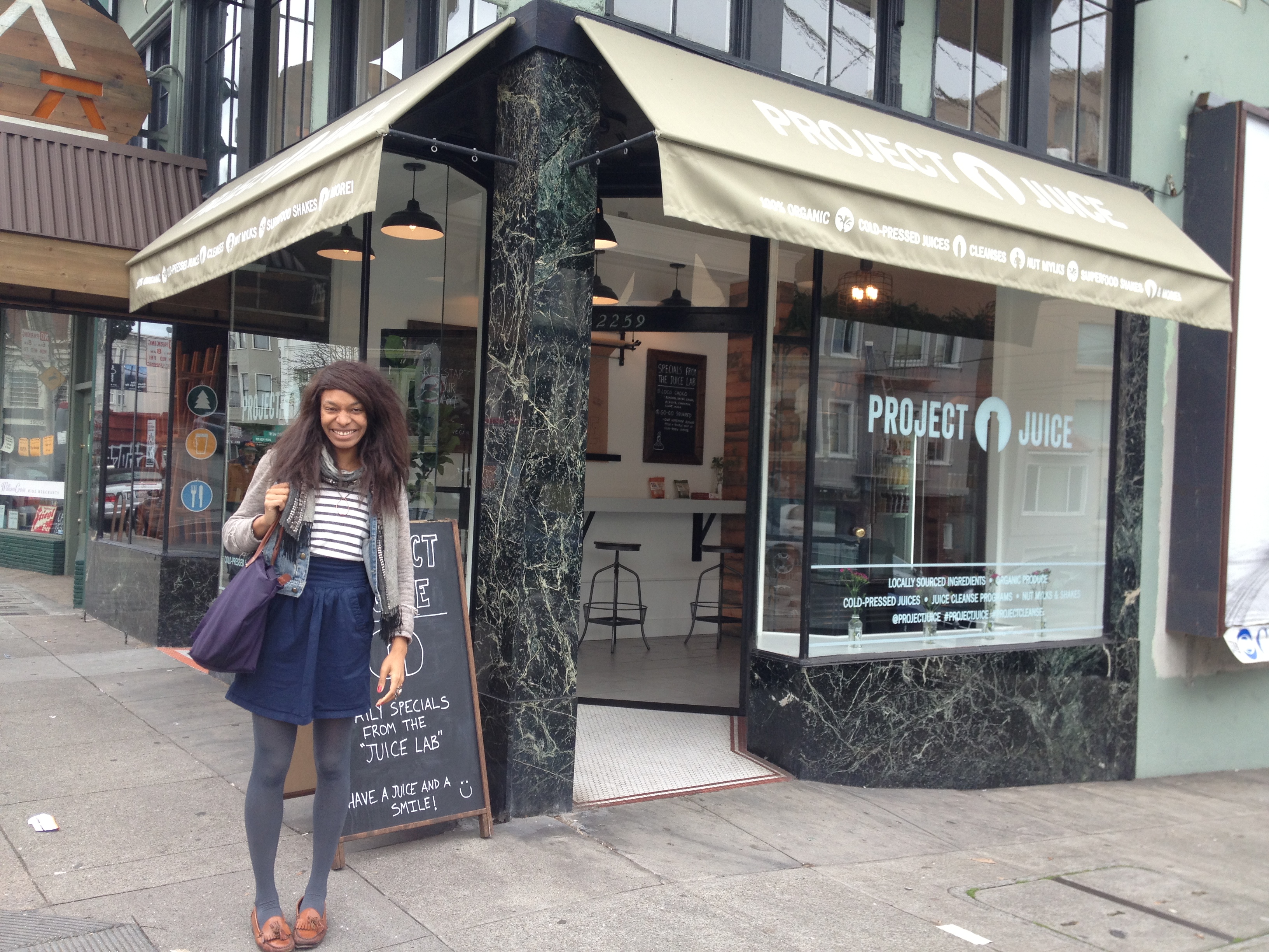
Juice at Project Juice (polk street, SF) with Nkechi 

Image


always fun rolling through SF with Nkech, even if for a quick rendezvous..she is a fellow 

Integrative Nutrition graduate.  

Image

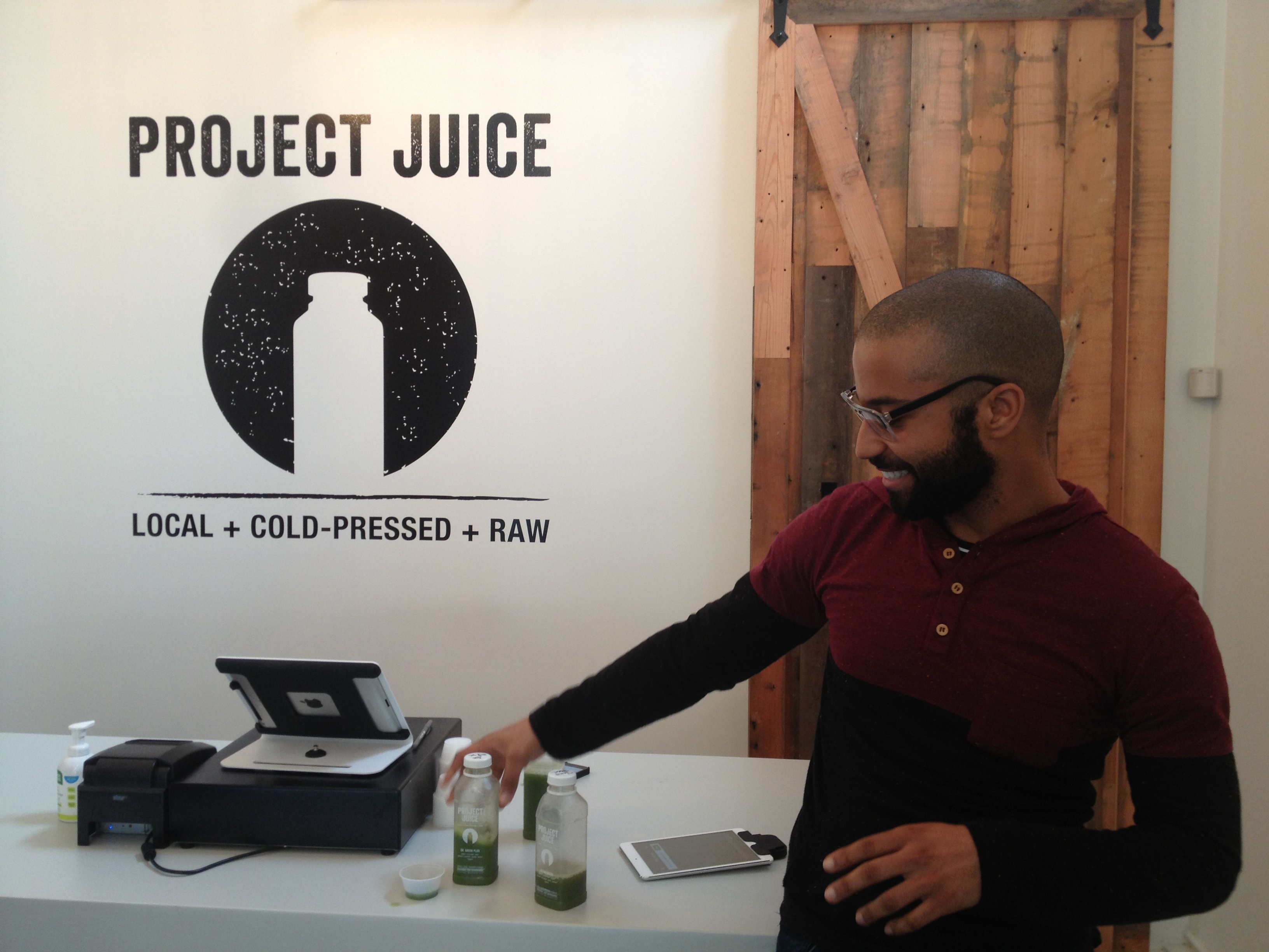
Akeem giving us a generous taste of their Greens line.. from earthy to sweet (one right in the middle with a splash of lemon & apple hit the spot). 

N downing the “Flu Shot” Elixir – 

Image


Image

** Cool place, the only issue was that their juices are HPP (info below) – not technically as fresh as you can get, but there is currently a lot of controversy on this subject. 

high pressure processing (hpp), also described as high hydrostatic pressure (hhp), or ultra high pressure (uhp) processing, subjects liquid and solid foods, with or without packaging, to pressures between 100 and 800 mpa. process temperature during pressure treatment can be specified from below 0 °c (to minimize any effects of adiabatic heat) to above 100 °c. vessels are uniquely designed to safely withstand these pressures over many cycles. commercial exposure times at pressure can range from a millisecond pulse (obtained by oscillating pumps) to a treatment time of over 1200 s (20 min). in contrast to thermal processing, economic requirements for throughput may limit practical exposure times to less than 20 min. pressures used in the hpp of foods appear to have little effect on covalent bonds (tauscher 1998; 1999); thus, foods subjected to hpp treatment at or near room temperature will not undergo significant chemical transformations due to the pressure treatment itself. hpp may be combined with heat to achieve an increased rate of inactivation of microbes and enzymes. chemical changes in the food generally will be a function of the process temperature and time selected in conjunction with the pressure treatment.


Day 61

Visit to GROW – A Sustainability Themed Art and Garden Education Center

Adorable and knowledgeable Star gave me a quick tour..

Image

This is their Aquaponic System/Fish Tank.. awesome they had 100% growth rate in their seeds (planted in peat pots). 

All of Grow’s plants are native 🙂 

Image

Image

Image

Image

yarrow – smells so good, make a very relaxing tea too 🙂 

Image

Day 60

Muir Beach Overlook. 

Image


Image

Image

Muir Beach Overlook is part of the Golden Gate National Recreation Area. People may visit this cliffside park when driving on Highway 1 north of San Francisco, California and south of Stinson Beach, California. It has views of Pacific oceanside cliffs and on clear days you can see San Francisco. You can also view migrating blue whales between November and June.

Location:

.5 miles north of Muir Beach on Highway One in Marin County

History:

Muir Beach Overlook contains several historic base-end stations. From these stations, soldiers viewed ships and triangulated the distance, speed, and direction of these ships in coordination with different stations. These stations were mostly important for artillery units stationed on the coast to attack any invasion. They gained particular importance during World War II immediately after the bombing of Pearl Harbor when many in California feared San Francisco or Los Angeles would be the next target. With the advent of radar and its widespread use, these stations became obsolete.

A few of them remain open like ruins where you may enter them to get somewhat of a perspective of the soldiers who were therein stationed.

Info on NPS site: http://www.nps.gov/goga/planyourvisit/muir-beach-overlook-accessibility.htm

Image

Image Mu


Day 59

Historic sites ROCK.  Fort Point Site, today’s first.

Image


Image

Image

Image

Image

Image

Fort Point has stood guard at the narrows of the Golden Gate for over 150 years.

The Fort has been called “the pride of the Pacific,” “the Gibraltar of the West Coast,” and “one of the most perfect models of masonry in America.” When construction began during the height of the California Gold Rush, Fort Point was planned as the most formidable deterrence America could offer to a naval attack on California. Although its guns never fired a shot in anger, the “Fort at Fort Point” as it was originally named has witnessed Civil War, obsolescence, earthquake, bridge construction, reuse for World War II, and preservation as a National Historic Site.

Built for the Civil War

Fort Point was built between 1853 and 1861 by the U.S. Army Engineers as part of a defense system of forts planned for the protection of San Francisco Bay. Designed at the height of the Gold Rush, the fort and its companion fortifications would protect the Bay’s important commercial and military installations against foreign attack. The fort was built in the Army’s traditional “Third System” style of military architecture (a standard adopted in the 1820s), and would be the only fortification of this impressive design constructed west of the Mississippi River. This fact bears testimony to the importance the military gave San Francisco and the gold fields during the 1850s.

Although Fort Point never saw battle, the building has tremendous significance due to its military history, its architecture, and its association with maritime history. To learn more about Fort Point before, during and after the Civil War, please visit Fort Point, 1846-1876.

Army’s use of Fort Point during the 20th Century

In the years after the Civil War, Fort Point became underutilized and was used intermittently as an army barracks. The pre-Civil War cannons, so valuable when they were originally installed, became obsolete and were eventually removed. During World War I, the Army remodeled Fort Point for use as a detention barracks, though the building was never ultimately used for that purpose. During the 1920s, the property was used by the Presidio for housing unmarried officers and different military trade schools.

The Golden Gate Bridge and Preservation Plans

In the late 1930s, plans for the construction of the Golden Gate Bridge also involved plans for the demolition of Fort Point. Fortunately, Chief Engineer Joseph Strauss recognized the architectural value of the Fort and created a special engineer arch which allowed the construction of the bridge to occur safely over the Fort. During World War II, Fort Point was once again used as temporary housing for soldiers. After World War II, the movement to preserve Fort Point for its historic and architectural value began to grow. Over the next 20 years, support for the preservation movement waxed and waned. In 1959, a group of retired military officers and civilian engineers created the Fort Point Museum Association and lobbied for its creation as a National Historic Site. On October 16, 1970, Fort Point became a National Historic Site.

 To learn more about the National Park Service’s Sesquicentennial Commemoration of the Civil War, please visit The Civil War: 150 Years.
Image
Image
Image
Image
 
up top.. sick view point..
 
Image
 
Image
 
parking lot.. not too shabby
Image
Image
Image
 
MUST SEE… awesome gem of history right in our back yard. Open Fri, Sat, Sun. 10am-5pm ENJOY!
Image
 

Day 58

First: Scrawled up Ingleslide Terrace Sundial – had no idea this even existed until a few days ago!

Image

“Unless you live near Ocean Avenue, or read a rare reference about it, there’s a good chance you don’t know that a big white sun dial exists. Because it stands within the original circular configuration of where the Ingleside Race Track operated between 1895-1905, a bogus story took root that the monument was an ornament left over from the track’s heyday. Many people believed the story, perhaps visualizing that gamblers should quit while their luck still shines. 

Touted as the world’s biggest sundial when it was built, this tranquil monument dominates a quiet cul-de-sac within the Ingleside Terraces residential area, an area of upper income homes created by the Urban Realty Improvement Company in 1909. 

Image

The secret: On October 13, 1913, fifteen hundred people attended the opening ceremony for this twenty-eight foot marble and concrete gnomon. It was to become the focal point of its own park and Ingleside Terraces. Oddly, the party for this sun-dependent clock was conducted at night. The timing had various symbolic reasons. That week the Atlantic and Pacific oceans kissed for the first time at the Panama Canal. It celebrated the planned opening of San Francisco’s Twin Peaks Tunnel, whose fast, reliable, and clean streetcar line was designed to serve people living away from the downtown area. And it was a romantic setting that would appeal to any young couple considering a new house. 

The narrator of the Sun Dial Park ceremony was Joseph A. Leonard, manager of the real estate company. Among the dignitaries present was Supervisor Charles Murdock, and the city’s most celebrated engineer, Michael O’Shaughnessy. With the Coast Artillery Band providing the music, grade school children costumed as sylphs unveiled each fixture. Beneath the sundial was a circular reflecting pool fed by a fountain. This had two brass seals and was surrounded by colored lights. A child emerged from the pool and represented the releasing of the water’s spirit. Encircling the area is a thirty-four-foot diameter clock face with Roman numerals.”

definite slide down:  🙂 

Image

BONUS **  encounter with Leo and son Noah. From Russia, Leo moved here with his wife 12 years ago and had Noah 6 years ago.  Love speaking with new faces and learning about their history.  This life is a wild intersection of characters.  We are all a teeny part of a huge, unfathomable whole. Love it.  Live with your eyes wide open. 

Image

Image

Day 56

Aquarium of the Bay – amazing what you can squeeze into a lunch break with a good friend and a lil’ planning.. 🙂 

Image


Image

Image

Aquarium of the Bay is a public aquarium located at Embarcadero and Beach Street, at the edge of Pier 39 in San Francisco, California. The Aquarium is focused on local aquatic animals from the San Francisco Bay and neighboring waters.

Image

Image

Image

Image

Image

Interesting.. average depth of the Bay = 18 feet. 

there are 144 species of anchovies?! 

Image

Day 55

Image


Today’s first was an unexpected kind gesture from another.  One of the clients I train weekly lives at the Paramount in SF – highrise, luxury living with awesome amenities – and the outdoor pool has always been appealing.  Typically I have to bounce right after our session but today had an extra 45 minutes and was joking that the time was ‘ideal for dunk’.  Goodness gracious ask and you shall receive! My client, C, rocks!  She not only insisted we make it happen, but ran upstairs to grab me a fresh towel.  Really, it is the simple joys in life.  My legs had been peddling all day and the dip was priceless. Promised to pay C’s generosity forward this week. Image

Image

post plunge and shower, soaking in some vitamin D..

Image

Day 53 Ala-mazing-mere Falls – whoa.

Image

Yep, Bay Area Folks, this gem is right in our backyard.  Could spend a lifetime exploring Pt Reyes National Seashore.  Short video for you, plus pics and logistics. Hope you decide to go!

Image

Image

Image

Image

Image

*kinda sketchy part of trail to get down to the beach to see the waterfall in full action. there is an option to hike to wildcat camp ground, then back track 2 miles via beach, but honestly this route is more than doable..if you are in company who is REALLY not comfortable rock scrambling I would opt for beach, but for 75% of folks, stick with the ‘alamere falls’ tangent trail off of coast trail. (you will see it about 1/10th of a mile past Bass Lake on your left. This is the signage:

Image

*this is the spot I mentioned..

Image

LOGISTICS: 

Trailhead is Palomarn Trail. Easy access.  Take Shoreline Highway towards Bolinas, turn Left on Olema/Bolinas Rd like you are heading toward Bolinas (road is not marked FYI, but first left you can take after winding 14 miles on HWY 1N from Tam Junction). If you hit “Olema Valley”, bust a u-turn.  About 2 miles, you’ll see Mesa Rd on your right, take that turn. Follow this ALL the way to the end, parking lot for Palomarin awaits you. Go on a weekday or EARLIER than 9am.  Unless you like crowds 🙂   Be safe, HAVE FUN!